
When we hear the name “Bronx,” we often think of the borough, crime, or environmental issues, but not everyone knows that the borough was named after the Bronx River, which in turn was named after Swedish settler Jonas Bronck. While the connection with the Swedish colonist is clear—he settled on the land now known as the Bronx and named the river—this article, brought to you by bronx.name, will explore the river itself and its significance to the borough.
Physical Characteristics of the Bronx River
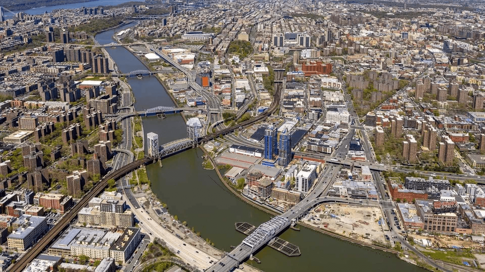
The Bronx River stretches 24 miles (39 km) and spans an area of 38.4 square miles (99 km²). Alongside the Hutchinson River, it is one of the only freshwater rivers flowing through New York City. During the city’s early settlement, its water sufficed for the small population. However, as the population grew, the city turned to the Croton River in upstate New York for water supply.
Initially, the river flowed from what is now the Kensico Reservoir in Westchester County. However, the reservoir’s dam, built in 1885, severed the river from its original source, leaving a small tributary as its headwaters.
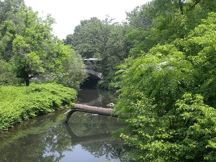
Today, the Bronx River flows from north to south, beginning near White Plains. It winds southwest through the northern suburbs of New York City, including Edgemont, Tuckahoe, Eastchester, and Bronxville. The river forms boundaries between Yonkers and Mount Vernon, as well as between East and West Bronx, Soundview, Hunts Point, the New York Botanical Garden, and the Bronx Zoo.
Key open spaces along the river include:
- Woodlawn Cemetery (400 acres),
- Bronx Park (718 acres),
- Crotona Park (128 acres),
- Soundview Park (196 acres).
The River’s History and Name
The Bronx River has historically played a vital role for Indigenous peoples. By the 17th century, it served as a boundary for sachems in the Wecquaesgeek Confederacy. The Siwanoy, a group of mollusk gatherers and fishers, also used its eastern shore as a border. This boundary remained when Dutch and English settlers established permanent communities.
The river’s name has evolved over centuries. One element, “acca,” appeared in Long Island toponyms like Accabonac, eventually morphing into the more European-sounding “aque.” Consequently, the river was once called “Aquehang.” In 1639, when Jonas Bronck purchased land between the Harlem and “Aquehang” rivers, the latter was renamed the Bronx River.
Transformation of the River
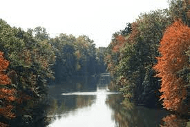
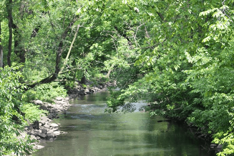
The Bronx River remained unchanged for centuries until New York City’s rapid development. By the 19th century, its headwaters included small streams near the Kensico Reservoir. The river meandered through forests, wetlands, beaver dams, and rocky valleys, notably in what is now the New York Botanical Garden. It emptied into the East River, passing through salt marshes.
In the early 16th century, the river’s abundant beaver population attracted settlers. Jonas Bronck acquired 500 acres of riverfront land from the Mohegan tribe for this reason. By the mid-18th century, the river powered 12 mills producing flour, paper, ceramics, textiles, barrels, and snuff. Surrounding forests provided timber for industry. The river’s water remained drinkable until the 1820s-1830s.
Pollution of the Bronx River
By the mid-19th century, industrial waste began polluting the river, stripping it of its natural beauty. One major contributor was the Lorillard Tobacco Company, which dumped waste into the river for years. Today, its former site is a historical landmark within the New York Botanical Garden.
In 1948, the river’s course was altered in Bronxville to accommodate an expansion of Lawrence Hospital. Archaeological excavations during this project revealed evidence of the river’s existence for centuries.
The Bronx River in the 21st Century
Today, the Bronx River faces significant environmental challenges. To combat this, environmental groups and the Bronx River Alliance are working to restore the river to its original state. Their goal is to transform it into a clean waterway. U.S. Congressman José Serrano has secured $14.6 million in federal funding to support these efforts, leading to a cessation of untreated wastewater discharge from municipalities like Scarsdale, White Plains, Mount Vernon, Greenburgh, and Westchester since 2007.
Despite these efforts, pollution remains an issue. A coalition of local agencies, citizens, and nonprofits has developed a watershed management plan to reduce river pollution and improve water quality.
Since 2006, the river has been restocked with alewives from Connecticut. These fish spawn in the upper river during summer and migrate to the sea in fall, returning after 3-5 years to reproduce. This reintroduction has continued for five years to establish a sustainable population. Alewives play a crucial role in the ecosystem by reducing eutrophication—a process in which excessive nutrients cause harmful algae blooms.
Efforts also include building fish ladders over three dams to grant fish access to spawning grounds. One such ladder was completed in 2015 at the 182nd Street Dam.
In February 2007, a beaver was spotted in the river for the first time in 200 years, sparking joy and excitement. Named José Serrano in honor of the congressman, the beaver was joined by a second one in 2010, doubling the population. Beavers are vital to the city’s ecosystem and are even depicted on New York City’s official seal and flag.
Recreation and Renewal
Today, the Bronx River is a recreational haven for New Yorkers. Its banks feature bike paths, green spaces, canoe routes, monorails, parks, walking trails, and kayak piers. Visitors can also enjoy waterfalls and fishways, which reduce predation, limit competition, and prevent hybridization and disease, supporting fish population growth.